CLINICAL TRIALS
Underrepresentation has an address.
Geographic intelligence for trial site selection, community outreach, and retention, census tract by census tract.
Three questions trial teams can't answer today
01
Where do underrepresented, trial-eligible populations actually live?
02
What stands between them and a site?
03
Did outreach, enrollment, and retention reach them?
Variate answers all three.
Site enablement
Ranked geographies for sites and community partnerships, based on where unreached eligible populations actually live.
Outreach targeting
Tract-level maps of who current trial infrastructure can't reach.
Retention
Transport-gap flags that predict a missed visit before it's missed.
Inclusion benchmarks
Outreach, enrollment, retention, and site readiness, measured comparably across geographies and populations, so inclusion is proven, not promised.
Built on real data, answered in plain English
200+ federal health and social variables, including tract-level disease prevalence for asthma, COPD, and arthritis (CDC PLACES), fused with social vulnerability, transportation, and health-infrastructure data. Ask a question in plain English; get a map with population counts in about ten seconds. No GIS analyst required.
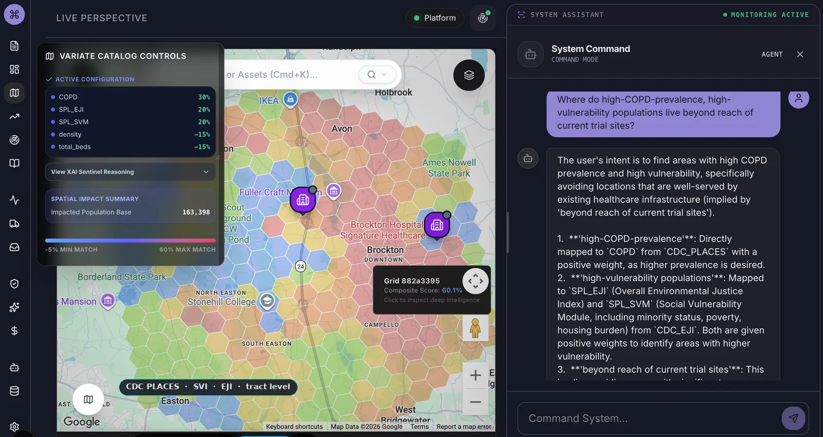
A real question against real federal data: CDC PLACES, census-tract level. Answered in about ten seconds.
Why now
FDA Diversity Action Plans make inclusion a requirement. The shift to community-based and decentralized sites makes it a geography problem. The layer that finds underrepresented populations and proves they were reached barely exists. That's the layer we built.
Live in production · HIPAA-aligned with a signed BAA · Population math done properly, never county averages smeared across empty space · When the model is unsure, it says so, and a human decides.
Read our analysis: Accelerating Clinical Trials →Planning a trial in communities you can't see clearly?
Email mike@variatehealth.com
Geography is healthcare's operating layer. Built by the person who answers the email: mike@variatehealth.com. One email. The founder reads it.